


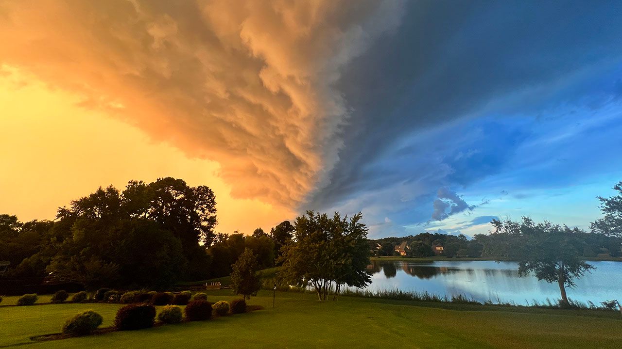
We hear it all the time from meteorologists. “A cold front will move in and bring storms,” or “a warm front is heading our way with light rain.”
But why do we expect certain weather conditions with each front?
To understand how warm and cold fronts work, we must first learn what fronts are.
A front is a boundary between two different air masses at the surface of the Earth, with warm air on one side and cold air on the other.
The bigger the difference in temperature, the stronger the front can be. The variation in temperature is more prominent in the fall, spring and winter.
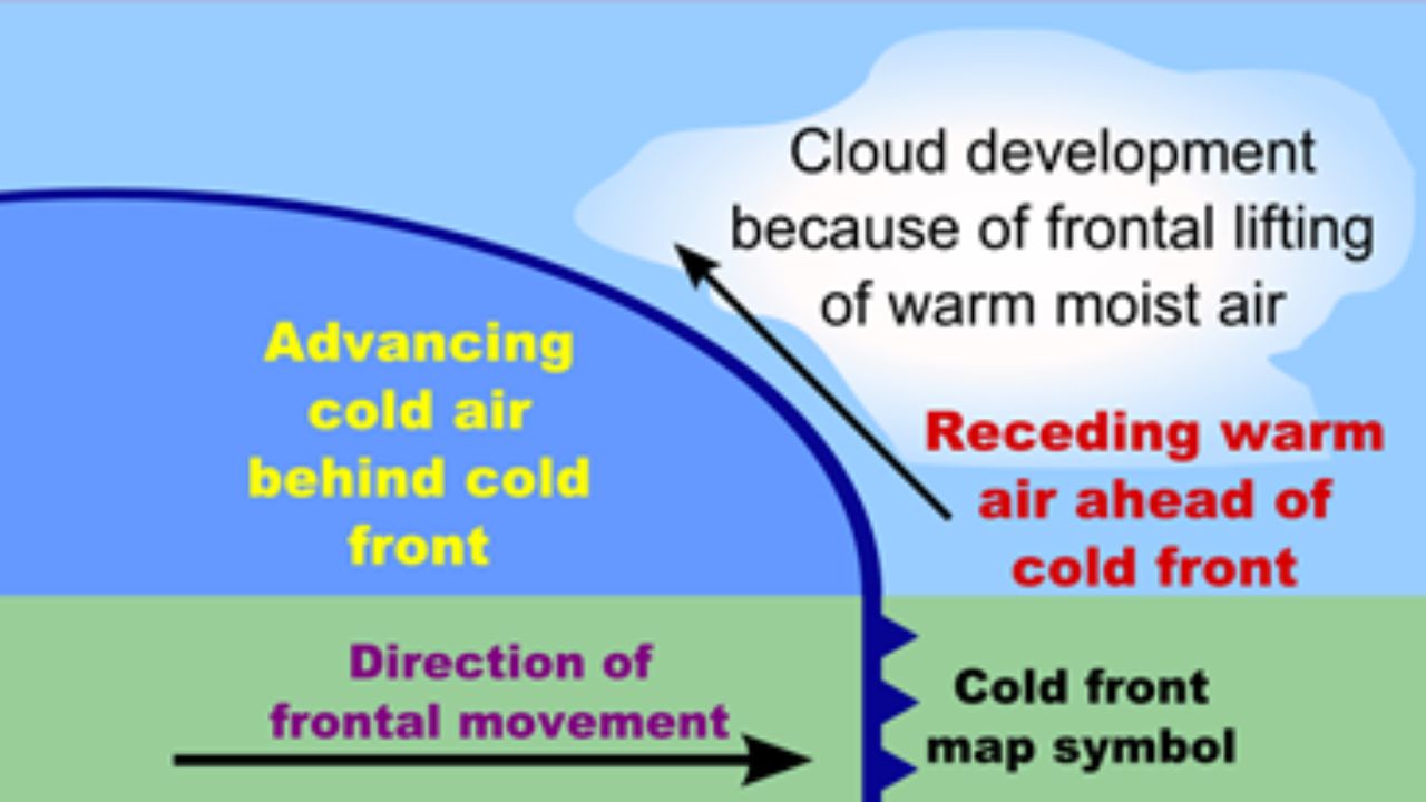
With cold fronts, depicted by a blue line with triangles on a weather map, the slope is steeper than what you would find in a warm front.
This means when the cold air clashes with warmer air, the warm air travels up the slope faster. As the air rises, it cools, condenses and produces clouds and precipitation. This quick rising motion often leads to showers and storms, and occasionally, severe thunderstorms.
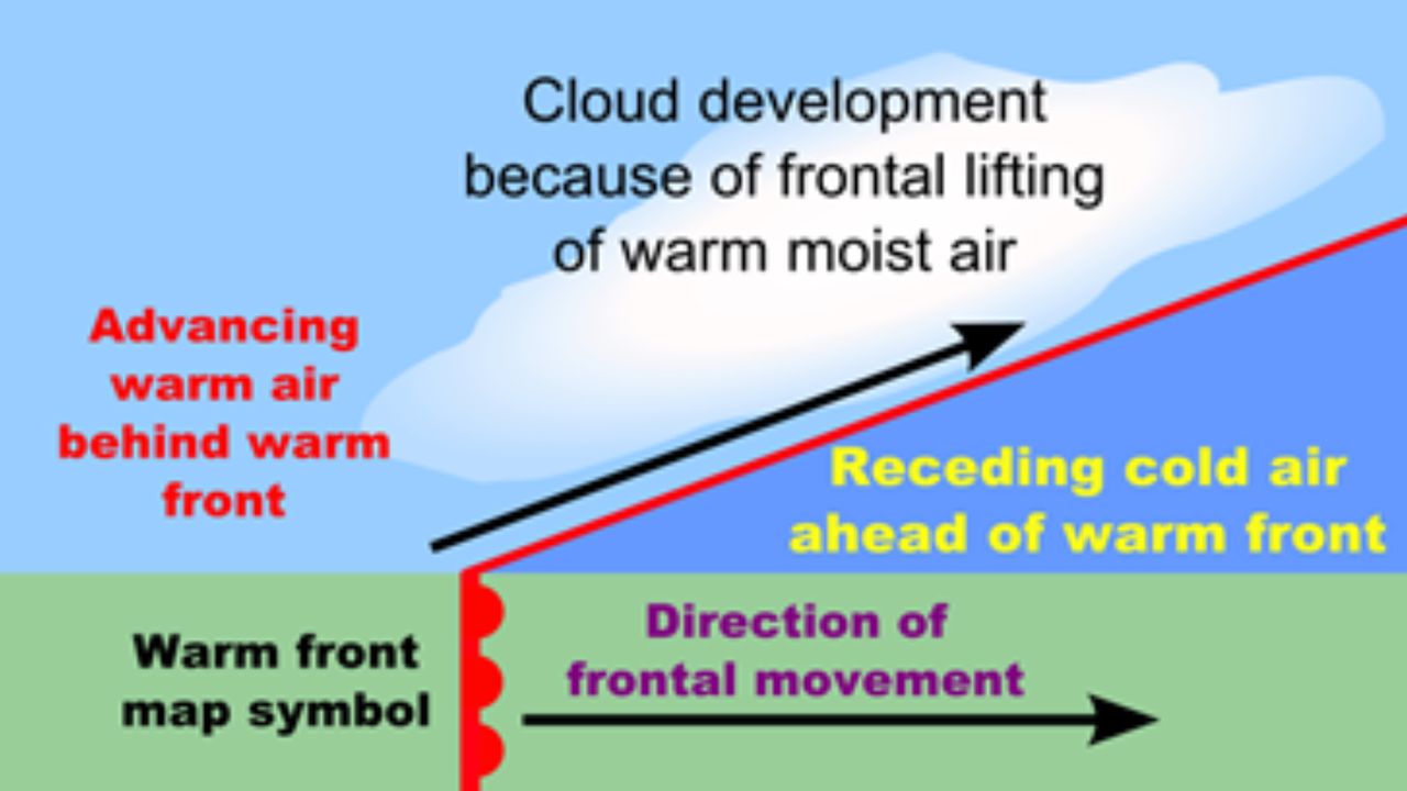
With warm fronts, the slope isn’t as steep, which leads to a gradual rising of air instead of a quick motion. The outcome is more steady and widespread precipitation, with some storms possible. You’ll recognize these fronts as a red line with half circles on a weather map.
We also have other fronts. The more common one you might’ve heard of is a stationary front. These fronts appear as a mix of red and blue colors with triangles and half circles, like a cold and warm front mixed. They occur when an air mass isn’t strong enough to move another, causing them to stall.
We associate these fronts with cloudiness, and some precipitation can also happen. Occasionally, they can produce storms.
The other one is an occluded front, depicted by a purple line with triangles and half circles.
Because a cold front moves fast, they can sometimes “catch up” to warm fronts.
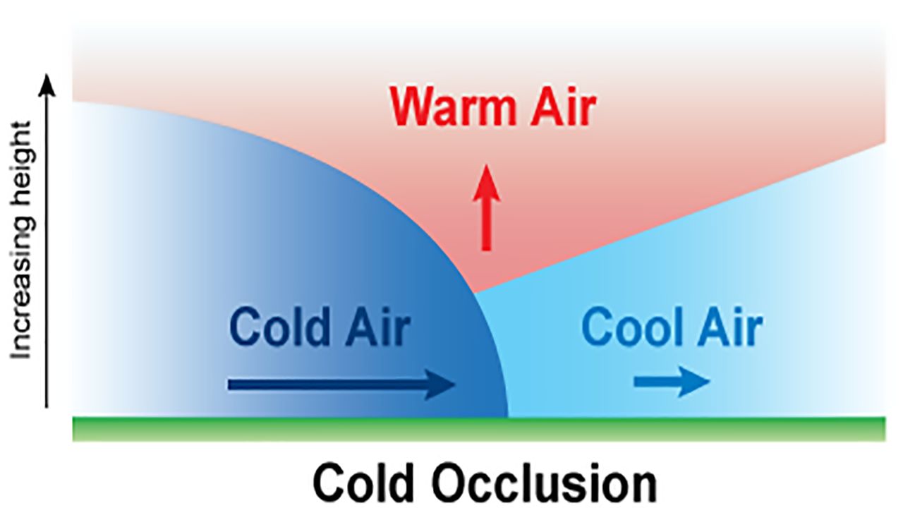
The cold air from the cold front meets with the cool air ahead of the warm front and pushes the warm air higher into the atmosphere. This can bring precipitation along the occluded front and cumulonimbus or nimbostratus clouds.
The definition above is for a cold occlusion, which is more typical, but warm occluded fronts can also occur.
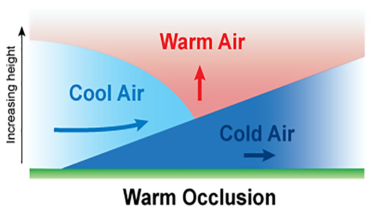
A warm occluded front occurs when the cold front that catches up to the warm front has warmer air than the air in front of the warm front. The cool air will slide up the colder air, with warm air staying aloft.
Weather ahead of this occlusion mimics weather associated with a warm front. However, weather associated with a cold front can occur near the upper cold front.
Now that we’ve gone over what each front is, you’ll have a better understanding of what to expect when your local meteorologist says one is on the way.
Our team of meteorologists dives deep into the science of weather and breaks down timely weather data and information. To view more weather and climate stories, check out our weather blogs section.