


The unusually warm weather that has persisted for the past two weeks is coming to an end this weekend.
What You Need To Know
- Pop-up showers and storms this afternoon and evening will occur
- A storm may pulse to severe limits with damaging wind gusts the primary threat
- A cold front will pass through late tonight and early Saturday
- The cold front may also cause strong to severe storms
The Storm Prediction Center has put us in the slight risk category for severe weather.
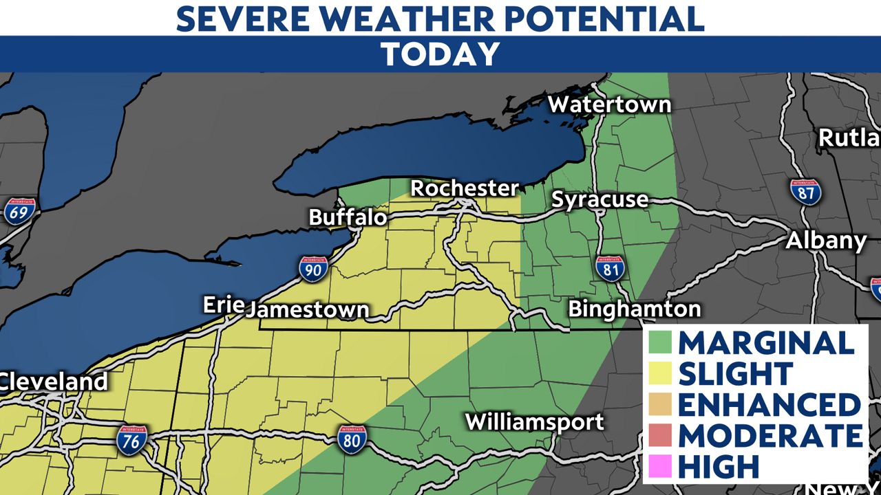
What does 'Slight Risk' mean?
It means that there is roughly a 10% to 15% chance of a damaging thunderstorm wind gust within 25 miles of a point on a map. In other words, your home. In today's weather setup, there is even the threat of a brief, weak tornado. The chances of that occurring near you is even less at 5%.
The bottom line is to stay weather-aware this afternoon and evening. In these scenarios, the most you will see is a heavy shower or a thunderstorm. However, there is a small possibility of severe weather, especially if we get a few hours of sunshine in during the day.
Stay safe and sign up for severe weather notifications here.