


Morning clouds clear a little earlier today, leading to an even warmer afternoon with daytime highs in the upper 80s to low 90s. So this first weekend of November ends with summer like heat and humidity. It will be another close call for today's record high in Austin. The forecast calls for 86, and the record high today for Camp Mabry is 88 set in 1963. Clouds increase overnight, setting up another gloomy start to our Monday morning with fog and drizzle possible at times.
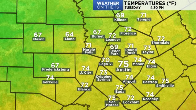
Temps now:
Winds + gusts at this time:

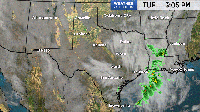
Clouds continue streaming from the west/southwest into Texas, but dry conditions are expected this afternoon which is great for travel. Our next cold front does move into the Panhandle today from the Plains, but will stall over the Red River into Tuesday without any showers or storms.
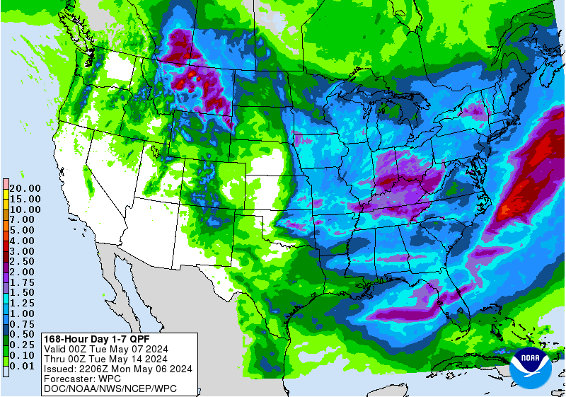
The front moves into Central Texas by Wednesday morning with gusty north winds and scattered light to moderate showers. We start in the 50s, and the warmest temperatures of the day will likely be reached in the morning. If we do warm up at all, it might only be 4 to 5 degrees, so talk about a big change! Wednesday will be 20+ degrees colder compared to Tuesday, so it's back to jacket weather! Showers will clear from west to east by early Thursday, and morning temperatures will be down in the 40s. We will warm up a little more during the afternoon, but highs in the 60s are still about 10 degrees below average. Rain totals are trending a little lighter today, and the 7 day rain outlook from NOAA still shows the potential for 0.1 to 0.25 inches areawide.
Friday looks just as cold as Thursday, but with more sunshine. Moisture returns on Saturday ahead of our next weak cold front set to arrive on Sunday, so we'll call for a 20% rain chance this weekend. This front brings lows in the 50s and highs in the 70s, closer to normal, as we start next week.
Plan here with the 7 day forecast.
-Meteorologist Emily Borchard